August 26, 2014
The Thin Gray Line
Look at a map, even the most detailed maps and you will find lines running across the page, red ones, blue ones, yellow ones, black ones and gray ones. If the map is well detailed, you may even find thin gray lines, or even ones with the thinnest double gray lines, or maybe, if the map is really detailed, a dashed gray line. The big red and yellow lines are the fastest way between two points .... big expensive, heavily travelled multi-laned highways. These usually connect big cities together, and slide right on by the tiny little towns and villages along the way. These are for people who want to put a lot of miles behind themselves from morning until night. The black lines and small blue lines, are for secondary roads, those little roads of yesterday that connect all the little towns and local people like a connect the dots game. Then there are the wider gray lines, still local roads, mostly paved that locals depend on more than tourists. Then ..... there are the adventure roads ..... the tiniest little gray single and double dashed lines on the most detailed of maps. These are where the real adventure lies. There may even be some that only local people know about and pass from one to another by word of mouth. These are not the kind of roads one seeks while in a car, but a bicycle is perfect. Go back 100 years, and this was the kind of roads bicycles were primarily used for. Once in a while you find a real gem, like this one in southern Lincoln County, Oklahoma. This one, you won't find on any map, except for Google Earth.
This old road came to my attention from the remarks of a long time resident. The road itself was a remnant of U.S. Highway 62, now bypassed by a more modern highway, but here and there a small section of original road remains. This one led back to an old riveted iron bridge most likely from the 1930's. I might never have found this if not for my bicycle as it is not the kind of road you would want to travel down in a car.

The bridge allowed the road to pass over this little creek far below.

So many of these old highways and bridges and even towns are disappearing because they have been bypassed by the big red and yellow lines, and people who are in too much of a hurry to get where they are going. Not too many of the local people even are aware of this road.
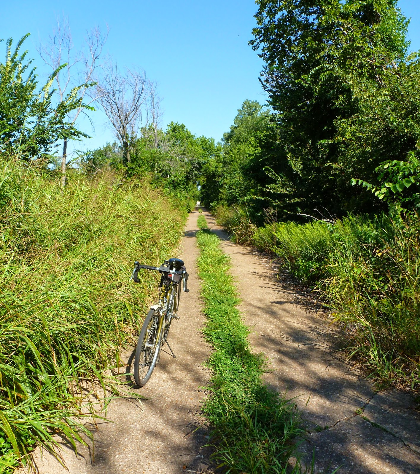
Then, there are the thin gray lines, and the double dashed lines, the ones that are usually not paved. These are the ones that define the meaning of adventure! It's what adventure bikes are built for. Gravelled roads, but sometimes only dirt, not even worthy of a "secondary road" designation. The "Third World" of roads. It is these roads where you can find the most wonderful sights. Like the early morning sun streaming through the trees.

The roads stretch on, not connecting towns, but instead, connecting farms and people.


There are times, however, when I begin to doubt the wisdom of my choice of roads. This one with it's soft, loose gravel was not one of my better choices. Still, with a sturdy framed bike designed for this type of riding, some low gears, and wide tires with a tread designed to handle loose surfaces, it was entirely manageable. My definition of an adventure bike is one just like this one.

There are times, out here in the wilderness, when the locals look at you like they've never seen another living soul. Like these three curious critters.

Wildflowers have been prolific this year.

Once in a while, one stumbles across something unique that is rarely seen anymore. Like this early 50's Hudson.

Or ....as I like to call these .... "Mechanical Politicians" .... disseminators of bull sh*t, or in more acceptable terms a "manure spreader", an organic field fertilizing machine.

This used to be one of our most wonderful bicycling roads until the City of Shawnee closed it off a few years ago. It seems the old iron bridge on this road was condemned by the State Highway Department, so they just closed it off instead of repairing it. There are several ways around. Our club has been negotiating with the city to convert it into a bicycle and pedestrian path, and they have gotten so far as to install bypass bollards out on the road.
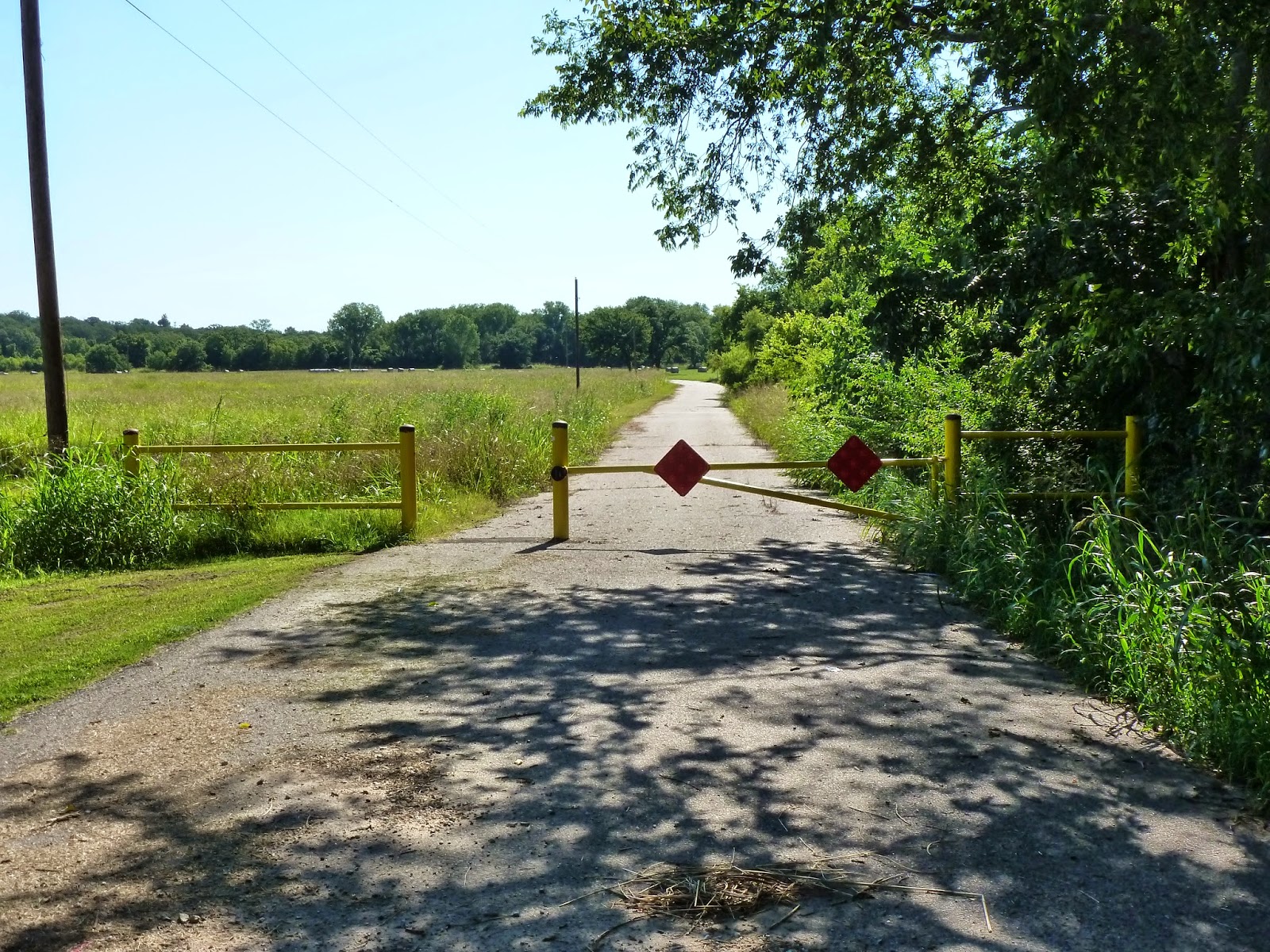
They have not, however, gotten around to providing access through the steel barrier and earthen berms that keep the curious from the bridge. This is entirely off limits to auto drivers, as the initial barricades are a half mile from the bridge. For me though, it was just pick up the bike, and lift it over the barricade and carry it over the berm ..... and here I am!

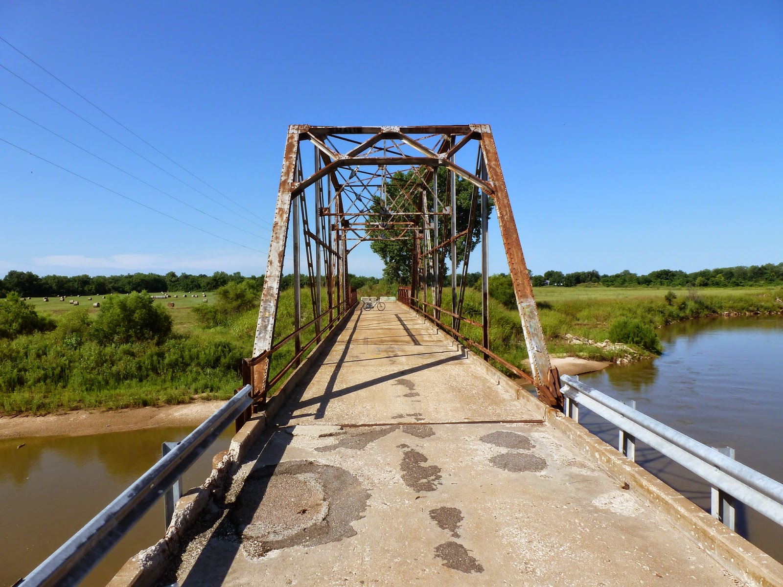
The bridge itself is still in very usable shape, at least for light use. The problem that closed it was that the concrete curbing's on the bridge edge and parts of the concrete paving was breaking up, however, the steel structure was still sound, and the paving easily would accommodate bicycles and pedestrians for many, many decades to come.

Another nifty old iron bridge! This one was initially a double span like the one I'm standing under, but part of it washed away and was replaced by the low truss that you can see a part of at the edge of the picture, making this bridge a bit unique. The bridge spans the North Canadian River just south of Shawnee.

On the picture below, one can see the damage to the roadway.
On some roads, one finds bridges that are truly not seen hardly anywhere anymore. This one was not only wooden on top, but held up, not by steel beams, but by large timbers under the bridge. There was a weight limit of two tons. Still in everyday use.

Then, off on another road at another time, is the ghost town of Ingalls, Oklahoma. The scene of a 19th century shootout between several U.S. marshals and members of the Doolin Gang. The outcome was one killed and two wounded after several hours and several hundred rounds fired. At one time, This town was an important little city in growing Payne County, on the railroad and destined to become an important trade center. The railroad fizzled, and Stillwater, which had the Santa Fe Railroad, became the major town instead. Today, this is all that is left of Ingalls, a few decaying buildings on one of the thin gray lines about 9 miles east of Stillwater, Oklahoma.

The next series of photos was from another blog post entitled "The Gold Belt Tour" from September of 2012. I thought it fit in well here because of the wonderful jeep trail in the Rockies that took me through history as well as a wonderful adventure. A ride that one would have difficulty negotiating with a car or a road bike. One sign said 4 wheel drive and high clearance recommended. I might add some very low gearing helpful in a few places. This ride was one that will stay in my mind forever. "Hole In The Rock", below.


If you wanted to see the rest of the write up on this Gold Belt Tour, use the archive and go to September 2012 to find it. It was indeed a fun ride. The purpose of this post was to instill a bit of adventure spirit in my bicycling readers to get off the blue,black, red and yellow lines, and seek out the thin gray lines where you might find anything ..... even a bit of local color like that below.
