A report of the ramblings of an old man and his bicycle. Up and over mountain roads,on organized rides, and along bike paths. Wherever the bike takes me and my camera. You've never Really seen a place until you've seen it from the seat of a bicycle!
Thursday, September 24, 2015
Black Hills, South Dakota
September 16, 2015
Traveling Day:
This was to be a traveling and sight seeing day with a bit of bike riding at the end, and the next morning which I lumped together all in one post. there are lots of photos, and only a small amount of narrative, hope you enjoy.
Panhandling Jackasses. Keep your windows up, they are not bashful about sticking their heads in and rummaging for food, or whatever. They'll steal what they find interesting.
Prairie Dogs are cute little critters to watch
I'm sure that this big old fellow is on the State Park's payroll to stand there and be photogenic. He did a good job. I noticed several others on our ride later that had the same pictures.
Typical of the roads through the park. If anyone is thinking of riding through here, the roads are narrow, heavily traveled, no shoulders, and full of gawking tourists. Very steep grades and sharp curves as well. That said, there was a bike expedition service at Sylvan Lake that rented bikes or you could ride your own and for a fee they would pick you back up from the bottom and bring you back ...... all downhill from there except for a few short steep uphills. I saw lots of bikes zooming down, most were faster than the cars.
Needles Eye Tunnel, tight squeeze.
The Needle's Eye.
Sylvan Lake
This is the end of my driving, just down the hill to Hill City from here, the rest of the time was on the bike. Hill City has the "1880 Train", It's not really from 1880, but that was when the gold rush began here, so they called it that. Very nice train display and museum though, and I like trains. I posted a video on my own page, but not able to post one here of the train pulling the loaded cars up the hill. This below is a good example of an early Ten Wheeler style locomotive on static display.
I had ridden my bike through here because the parking lot was full, and it was easier to get around with the bike. I also left here, and rode up the "Old Hill City/Keystone Road" to a vantage point for my video. Very hard pull coming out of Hill City on a bike. I was puffing as hard as the train when I got to where I wanted to take my video. So glad I didn't have luggage.
A Ten Wheeler Tank Engine. Normally used as a switcher or for short local deliveries, it didn't need a tender as it had a large fuel tank behind the cab and carried it's water in the tank above the boiler where it was pre-heated. These little engines were very powerful, and this one did a fine job. These were nicely restored period passenger cars.
A fellow could get a nice cold shower walking by here.
Rabbit Bicycle in Hill City. Stopped in for a bit and met the owner and chatted a bit. Very nice shop and pleasant people. Many rental bikes, sales and service.
Rode downtown and saw the sights. It's a very "artsy" town.
Look closely at the horse (click on it to bring it full size) and you will see it's made up entirely of junk. There are old wrenches, nuts and bolts, tractor hitch parts, shock absorbers .....you name it. After this, it was time for dinner, a shower and bed.
I met a nice local rider the next morning and we rode up the trail together. I went up 10 miles, and turned around. He was going to make a day of it and turn around at Rochford. I wanted to ride up the grade all the way just to see how well the Fattie would handle a long grade like that. It did just fine. The young man I was riding with was a bit stronger and faster than I, and kept me chugging along at 10-11 mph all the way up. A 20mph breeze against the backside helped here. I was still winded at the top, Phew ...
8 1/2 miles of some of the steepest grade on the trail here. Steady 3 1/2% to 4% grade to the top at Redfern.
The trail follows the highway off and on, here you can see the grade quite well.
One of many pretty little lakes
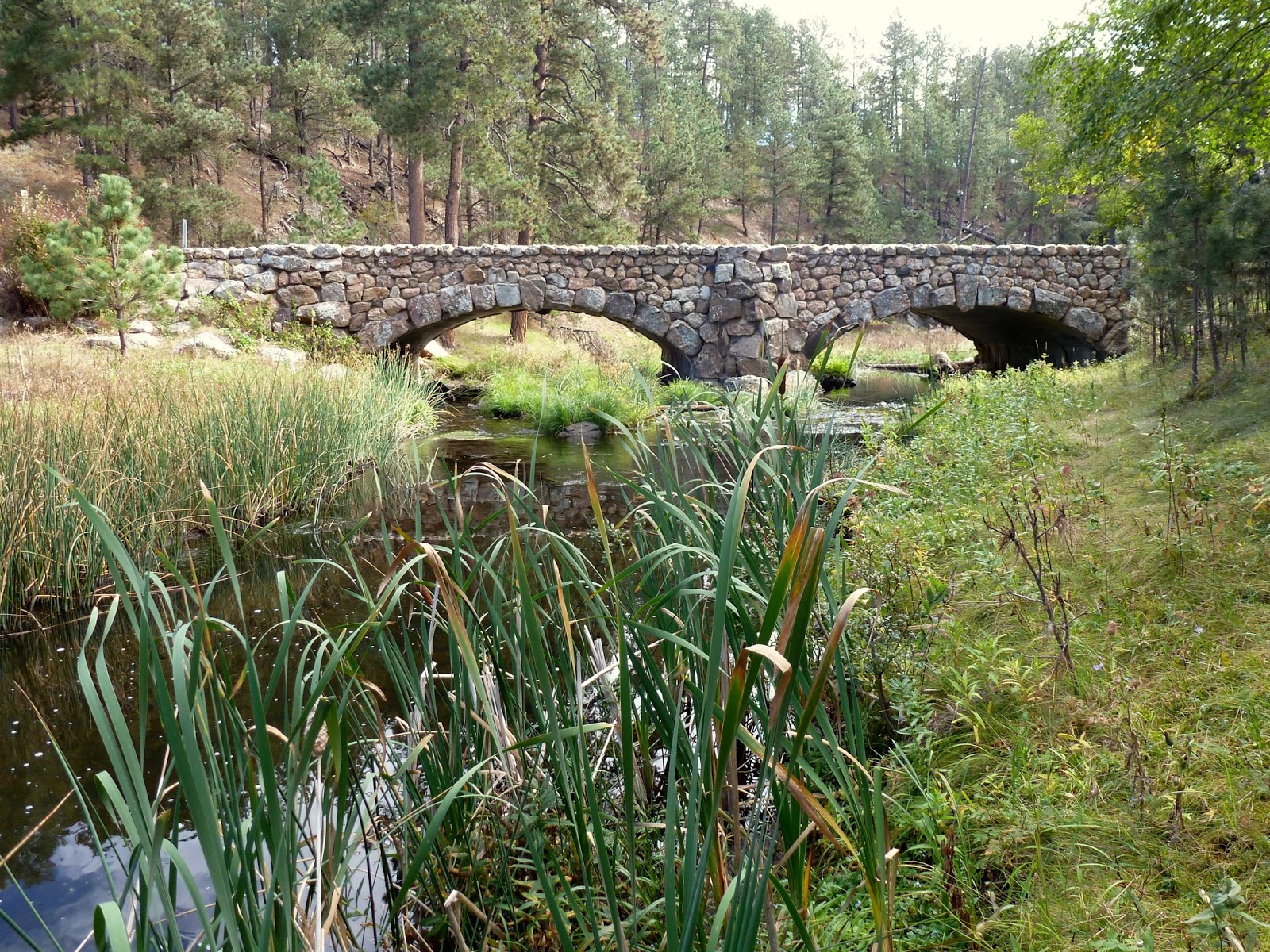
There are 109 bridges so one of the trail engineers told me. I was lucky enough to meet him at Edgemont and chat with him a bit. Very interesting fellow.
Hmmm ..... Who's the guy with the red coat? I gave the rider I was with my camera, and he rode off with it, zooming well ahead of me. I was beginning to wonder if I had made a mistake and lost my camera, but he stopped and turned around and took several of me coming up the trail, then returned my camera. And he took nice pictures as well.
Do it yourself water bottle refill, cold fresh water.
Redfern Trailhead. There was a concrete plant here at one time and you can still see the old foundations back behind here. There was drinking water, table and a pit toilet here.
This old rail car used to be the offices of the concrete business.
Trail up on top, heading down from Redfern.
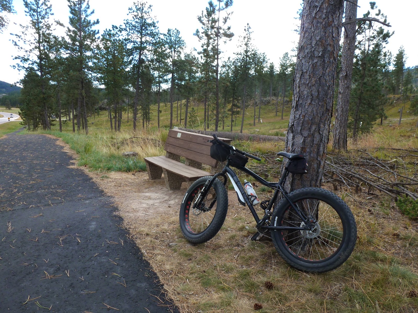
Hiding wayyyy in the back is a Fatbike.
Met a fellow and his wife doing the trail together on loaded bikes. When they got to Deadwood, they will turn around and ride back ro Edgemont.
Parts of the old concrete plant.
Local color.
Perfect little lakes abound for fishing
This is certainly a trail of much beauty, every inch of the way.
Really? Fly-speck Billy??
That afternoon, I drove down to Custer where I needed to be for my registration Thursday afternoon. I wanted to ride the short Mickelson Spur trail out to Custer State Park and Stockade Lake. Two pretty good hills on this all paved trail.
The Stockade at Stockade Lake. Dating from the General Custer's Seventh Cavalry days, it was nicely restored.
I was intrigued by the roof construction on these cabins, I had never seen this type of roof before. Interesting.
Stockade Lake in Custer State Park
You could have your own private island here. This one is a bit small, however ..... but it's green!
Trail bridge in the background
You didn't really think you'd get by without having to see a picture of horses, now ...... did you?
Saw several of these along this trail, along with a couple of deer that sprang up from the trailside just as I rode by them ....exciting for a moment. It happened wayyy to fast to grab my camera. Just a short 9 mile loop including the lake shore portion which is not part of the trail, but just a graveled county road.
From here, I needed to head back into town as it was just about time to pick up my packet. I had some misgivings when I signed up for this ride because of all the car shuttling and bus riding going on. As it turned out, it was a perfect way of handling 600 bike riders, gear, and bikes. I also had some trepidation about the sheer number of riders. I didn't need to be, as I never really saw more than 50 or 60 riders all day, and usually the same ones every day. Starting times were whenever you wanted to leave, some started at 7am some later all the way up to around 10am. They were scattered all over the trail. It turned out to be a really pleasant experience. I checked in, got my packet, made sure everything I needed was in my room, and drove down to Edgemont, left my car parked on Main Street, along with the others and caught the first bus back. Got back in time to enjoy some of the hors d'oveurs and draft Fat Tire they had there. If you do this one ...... the two little red tickets they give you in your packet ..... the ones that look like they should be for a drawing ...... are for the beer and wine. Mine was back at my room. Hoofed it back (car at Edgemont, bike in room) got my tickets and rode the bike back. The lady at the beer table was so surprised I would walk all the way to my motel and ride back just for a beer, she gave me two. I found a pretty lass to share the second one with. Stood around a blazing fire and ate their treats, drank their beer and made some new friends. A fun time was had by all. It got a little late before I realized I had to ride back in the dark with no lights on the bike. Made it back, and was looking forward to tomorrow.
Wednesday, September 23, 2015
Badlands Wanderings
September 15, 2015
Fulfilling a dream of several years now I decided to take a big trip this year and head for the Mickelson Trail in the Black Hills of South Dakota. There was no reason not to include a couple of other side trips as well. Several years ago I first heard about The Cowboy Trail winding across northern Nebraska, and thought it would be interesting. The trail itself is almost 200 miles in length, and I didn't have time in my schedule to ride the whole thing, but I could find time to stop in Valentine and ride a small bit of it. It almost seems, though, that I may have bit off a bit more than I could chew with the 700 mile first day. It's been a long time since I've put in that many miles in one day, and I was very tired when I arrived at Valentine at 6:30pm, but still determined to ride a bit of the trail. So, even though it was 95 degrees out and the wind was at 30 gusting to 45, I decided, "What the Heck" ..... I'm going anyway. It was short .... just 9 miles total, but I can say that I've ridden on the Cowboy Trail.
With the strong headwind and heading uphill, 8mph was all I could manage.
The big trestle from a distance. Long and high. Carried the freight across the Niobrara River, a wild, untamed and historical river through northern Nebraska. Now, it carries runners, hikers and bicycles.
The trail is rather pretty through here with the pines and cedars. As you can see from the tracks, the trail can get a little soft at times
Guess who on the big bridge.
Long ways down!
4 1/2 miles out, and 4 1/2 miles back to the motel, I was ready for dinner and a shower and bed. Tomorrow it's on to the Badlands of South Dakota.
After a good night's rest I felt much better, and a two hour drive later, I arrived in Interior, South Dakota and the entrance to the Badlands National Park. Driving to the Visitor's Center to unload my bike and start up Cedar Pass to start my ride.
Starting up Cedar Pass. I was warned by Park Rangers that a lot of cyclists misjudge this pass and have a bit of trouble making it up. I kept it in the big ring and didn't have a bit of trouble. 6% to 7% with a short bit of 10% and a mile and one half total. After about three quarters of a mile it drops down to about 4% for the remainder. It's steepest at the start. This year, however, they had a new twist ....... road construction, one lane closed. The flag people and drivers of other vehicles were very patient however, and I made it through the short quarter mile lane closure at 5mph. The picture below is the start of Cedar Pass from the visitor center.
Looking wayyy down there, you can make out the visitor center.
Made it to the top
Such an unusual terrain, you might be on the moon.
More climbing before my turn off onto gravel
Wind is a'blowin'
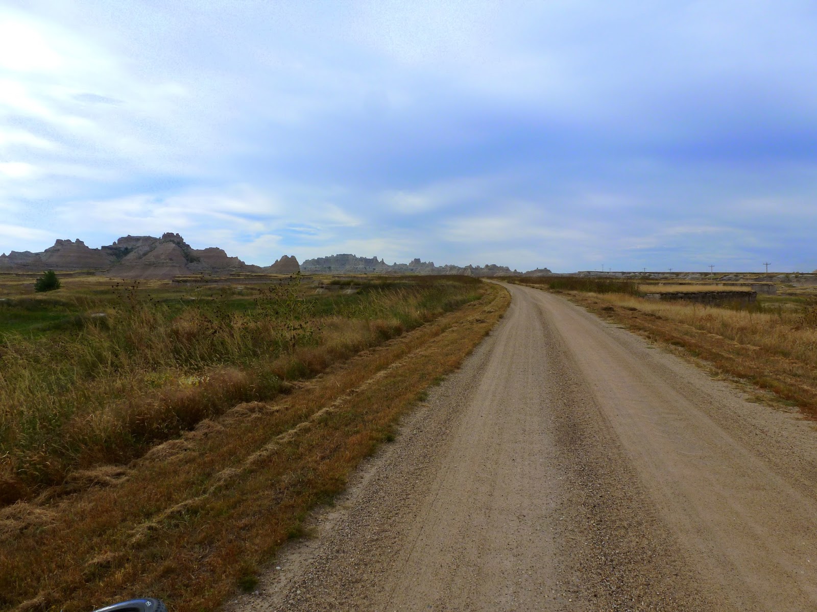
I took the "Old Northwest Road" off U.S. 240 right at the top of the pass, then proceeded north, downhill with the wind at my back, until the road made a sweeping turn to the east and back to the highway where I returned via blacktop into the wind and uphill. Hard ride back, not the best planning, but when you are vacationing, you take it as it comes. Do not forget your receipt or in my case, your Golden Age Passport or you will pay again getting back into the park on the return leg.
The gravel road at times get's a bit swoopy.
Almost missed these two ....... but they hadn't missed me ...
I did bootleg a short ride in and out on a hiking trail. Not really supposed to do this, but there was no one around, so I snuck in a shorty. Mountain bikes are prohibited on hiking trails within the National Park boundary. Shhhhh .....
I wouldn't want to meet up with this one while walking through the grass, I don't hear well enough to hear the rattle. This one, however is stuffed and behind glass in the Visitor Center, and is perfectly safe.
My short 28 mile ride is done here and now it's down the road to Scenic, South Dakota. Below is the rip-snortin' town of Scenic, South Dakota, for sale a few years back for $799,000. Still for sale I think.
The Long Horn Saloon, the sign even tells which Indian Tribes are allowed in there. Click on the picture and it'll come full size.
The Calaboose. If you look in the back, you can still see the bunk frame and springs. I think the thought of spending any length of time in there would make me a very honest boy ....
The town motel ...... Maybe run by a fellow named Bates?
Four miles south of town on the "Bombing Range Road" is "Sheep Mountain Table Road". My destination for the remainder of my Badlands Tour. Drove a few hundred yards up the road and found a pull out where I could park. Unloaded my bike and started up this ..
That washboard was there all the way back seven miles, never gave it up except when it became soft sand on the top. I didn't know what I was really getting into on this one, and it became very interesting.
Is this the Sheep (above)? And the "table" (below)? I thought, maybe. At least I could call them that.
The washboard never relented. I had 8 pounds of air pressure in the tires for the upcoming Mickelson Trail, and it was pretty rough. Uphill from the very start, it never flattened out. Yes the sky is really that blue ..... it amazed me. Oklahoma skies are almost gray by comparison.
A little color along with the mud color, Goldenrod, I believe.
Up into the hills
This doesn't look very steep, but it would prove to be the hardest climb I had the entire trip. I have never had my Fatbike onto the small chainring, but I did on this one. A mile and one half to the top, almost all at 2mph and struggling. Very rough with many washouts, it required a slow descent coming back as well.
More uphill ..... very steep, I didn't think it would ever end. This hill required several "Kodak Moments" to top.
Almost to the top and the washboard got even deeper, this is about three inches deep here. I tried to stay in the middle, but it didn't help much.
The constant wind was my only companion.
This was what it was all about. A forever view of the Badlands below. It was worth the climb after all. If you compare the size of the badlands spires to those at the beginning of my post, you will have some idea of the amount of climbing necessary to get to this vista point.
A view the other way, just to my left of the above picture.
A little ways above this vista point was this sign, and the road deteriorating into a two track very sandy trail. It was so sandy, in fact that I could not negotiate through it with the 8 pounds of air pressure in my tires, so I stopped and let out quite a bit of air, down to around 5 pounds. It worked much better in the sand after that.
There was no cure for the switchgrass that sliced my legs, arms and face, however, and finally I just gave it up and turned around at the 7 mile point.
The reduction of air pressure had one benefit I didn't think about. All that washboard coming up ....... was gone on the way back. What took me an hour and one half to accomplish to get up here was done in 20 minutes on the way back. Except for the crawl down the big hill, it was 22-24 mph all the way back to the car, and smooth as glass. Fatties RULE!! This ends my little tour through the Badlands of South Dakota. I could have easily spent several days here exploring backroads, but wanted to move on into the Black Hills in the morning after a night's rest in Rapid City.
Subscribe to:
Posts (Atom)